
Scan speed and depth
Watch texture, color, bubbles, and the way the current carries debris.
MI-G3 · Michigan regional system
This system covers resident brook-, brown-, and rainbow-trout water across the eastern, central, and western Upper Peninsula, from small wooded streams to larger rocky rivers.
Know the reach you plan to fish, check the day’s weather, flow, and water temperature, and save what you will need beyond cell service.
Open preparation guide →First-decision path
Watch where trout are feeding and choose Surface, Film, or Subsurface. Adjust Presentation → Depth → Weight → Change Fly. When changing the fly, refine Size → Shape → Color.
Choose Surface when trout are clearly taking insects from the top of the water. Match the size you see before changing shape or color.
Choose Film when trout are feeding in or just under the surface. Look for bulges, backs, and splashy rises.
Choose Subsurface when the surface is quiet. Improve presentation, then depth and weight, before changing the fly.
Regional signature: Broad caddis and stonefly support, Yellow Drake coverage, terrestrials, durable pocket-water dries, midge/nymph insurance, and compact streamers.
Read the river
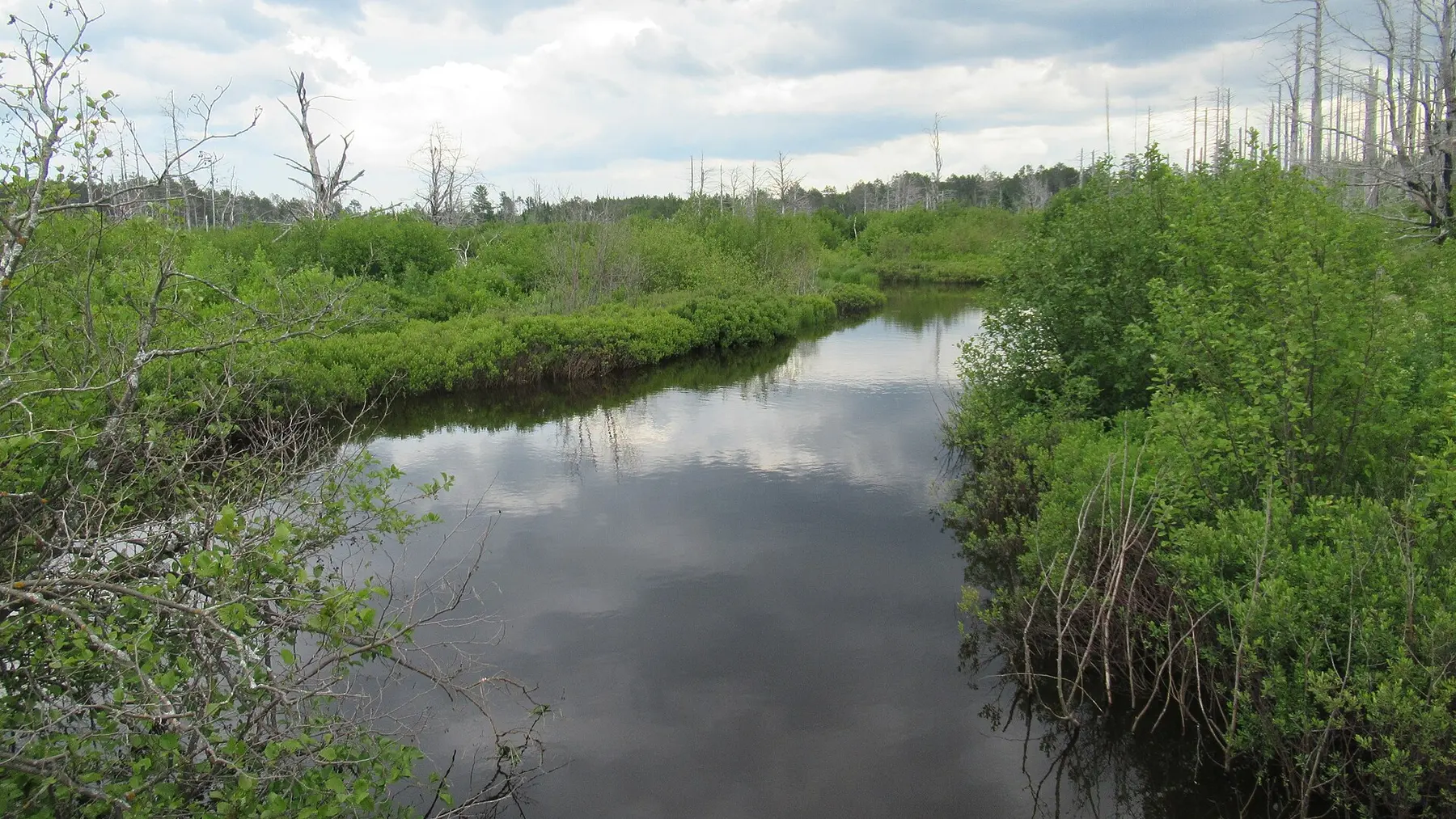
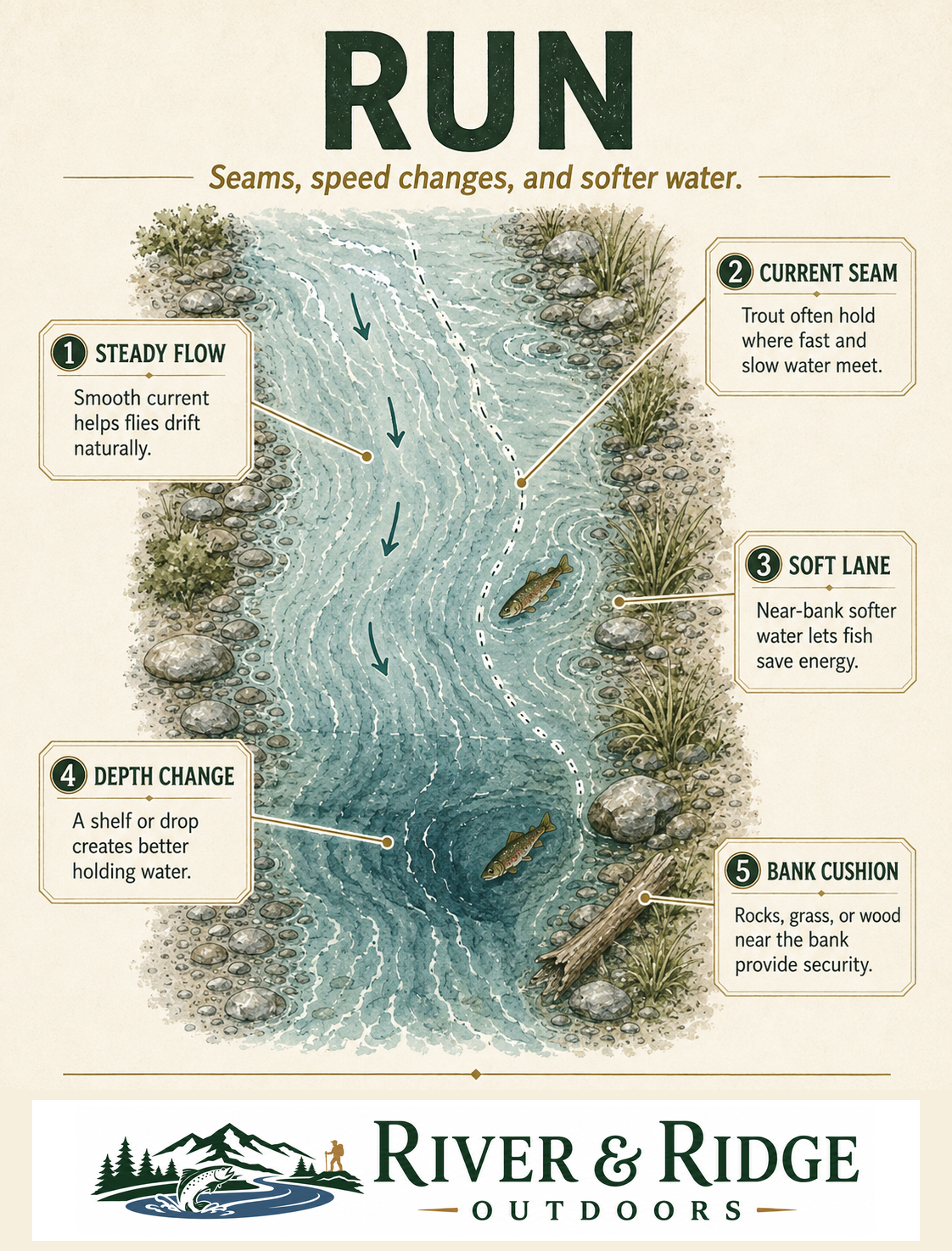
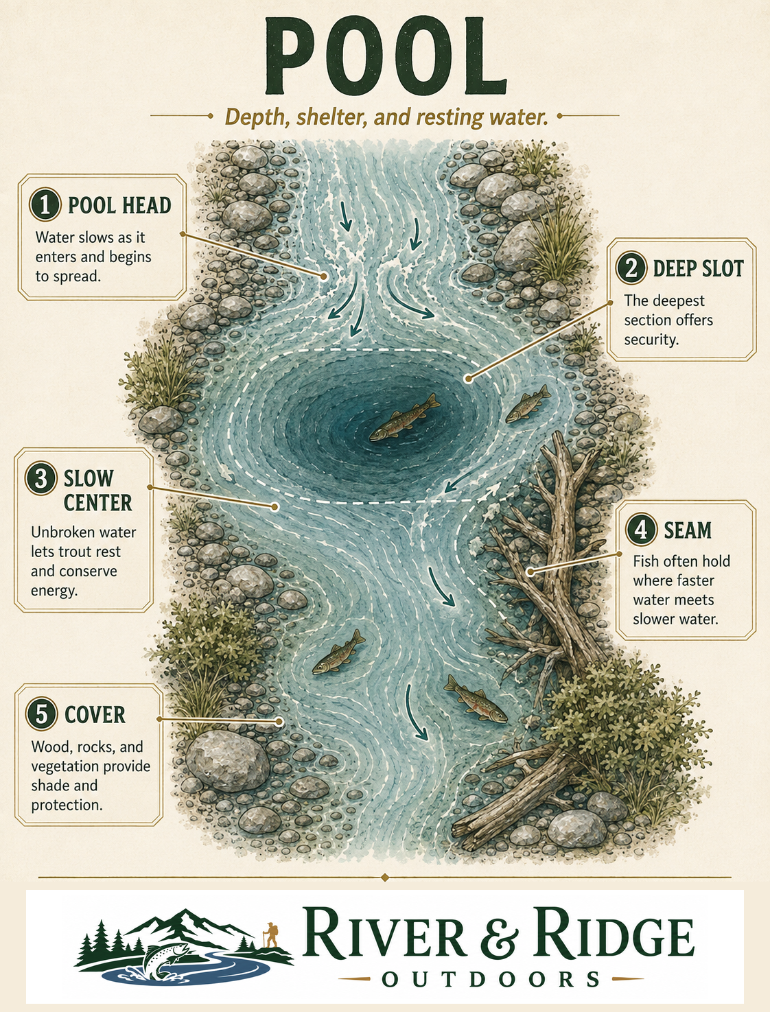
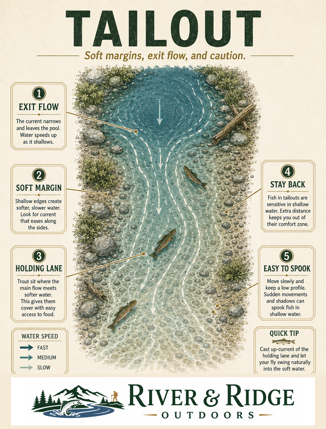
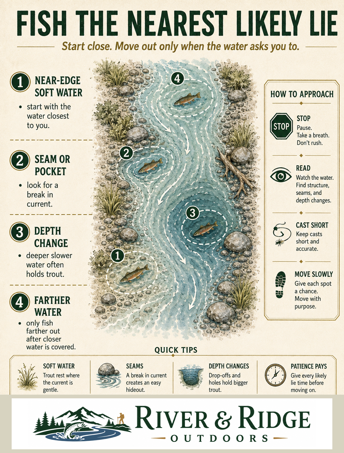
Real field photography shows the water as it actually appears. The illustrated guides make speed, depth, seams, cover, and approach easier to name.
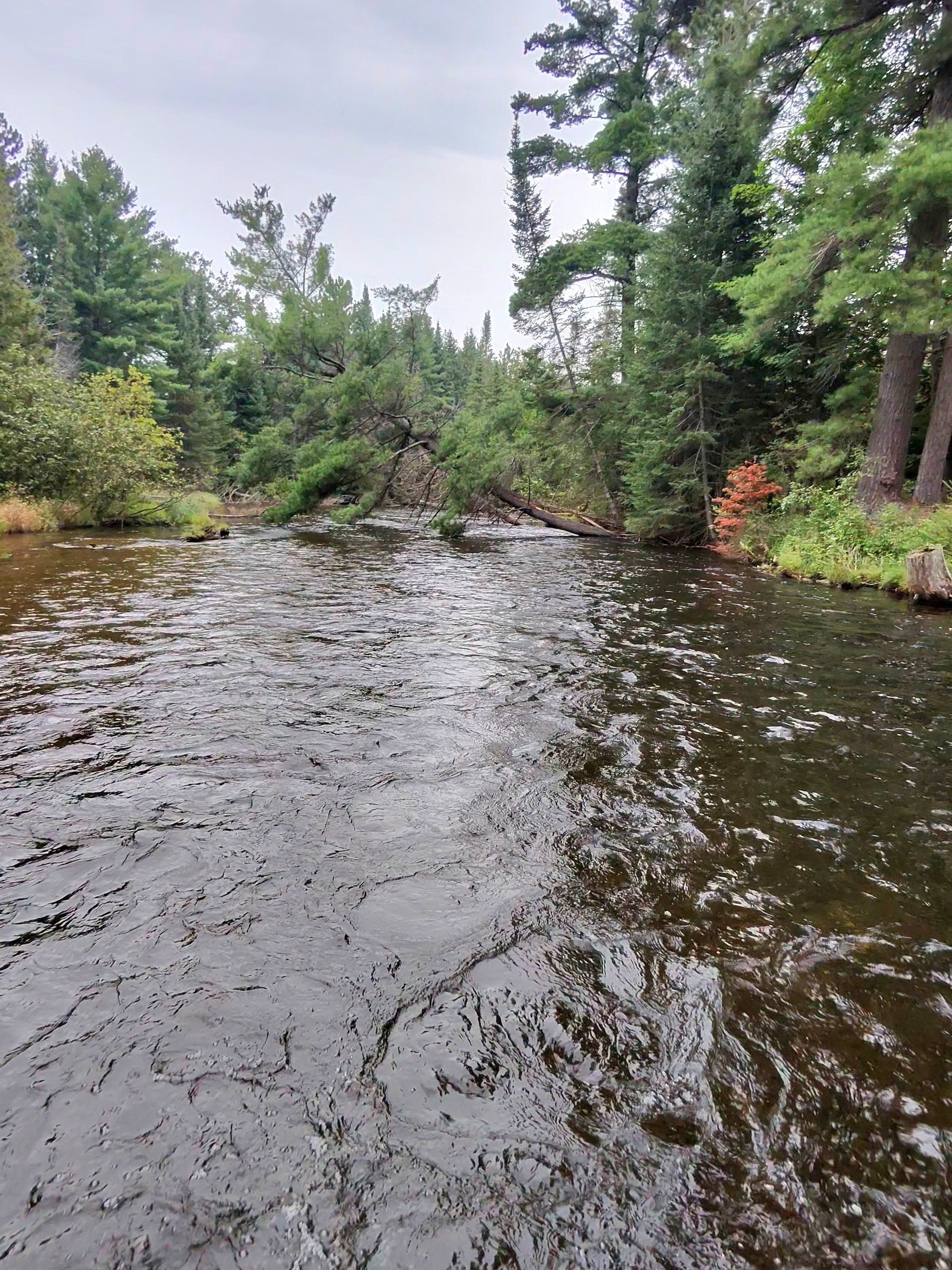
Watch texture, color, bubbles, and the way the current carries debris.
Look for seams, pockets, shade, wood, drop-offs, and softer water beside faster flow.
Work from the safe near water toward the seam and cover. On faster Upper Peninsula rivers, apply the same method while giving current and footing the final say.
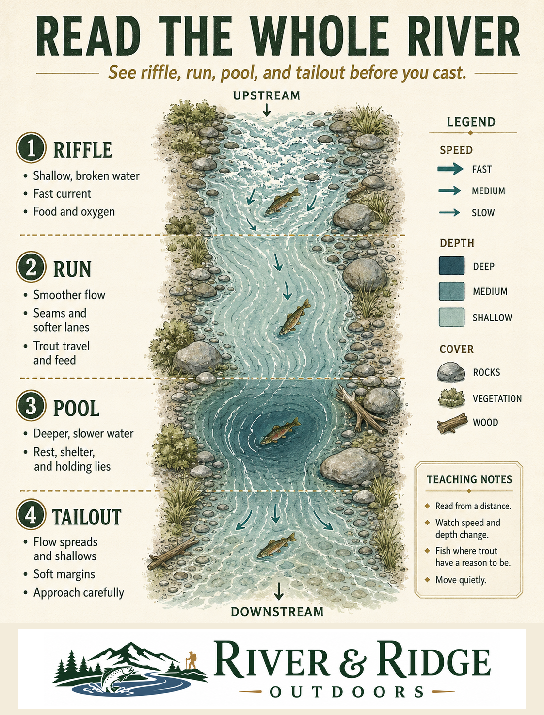
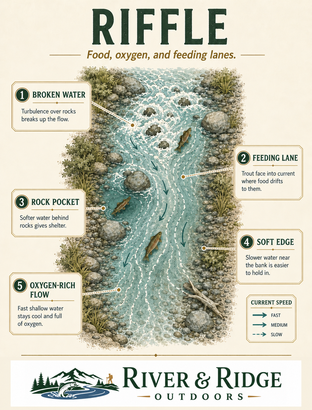
Field photos: River & Ridge Outdoors · Illustrated guides: RRO Training Illustration Library
Regional coverage
Use these descriptions to picture the river, its current, casting room, and common holding water. Open the regional map for individual rivers.
| Water family | Box fit | What the fishing is like |
|---|---|---|
| Fox & East Branch Fox | Core water | Classic eastern U.P. brook-trout water: small, cold, wooded, and often brushy, with beaver influence, woody cover, short pools, and intimate casts. |
| Two Hearted system | Core water | Remote, tannin-stained trout water with riffles, runs, deep wood, and changing width across the system. Expect a wilderness-style day built around mobility and versatile presentations. |
| Escanaba headwaters & Paint system | Strong fit | Headwaters begin as smaller cold streams and build toward broader, stronger rivers. Expect pocket water, gravel runs, deeper pools, and room for both compact and longer presentations. |
| Ontonagon tributaries & Brule | Selected branches | Western U.P. trout water shaped by steeper gradients, rock, gravel, pockets, and deeper holding water. Strong current makes line control and deliberate footing part of the fishing. |
Regional fit: This box covers resident-trout water from brushy eastern brook-trout streams to larger western U.P. rivers. The selected-river intelligence supplies travel, access, and current-condition planning.
Regional river map
Choose your river from the selection box or tap a numbered marker. You will see how the water fishes, how the box fits, typical wading, current temperature and weather, and where to begin.
Choose your river above to open its planning intelligence.
Map markers provide river-system orientation. Measured water leads the decision. The highlighted seasonal window provides historical context, and the local 24-hour forecast shows the likely warming or cooling direction. Active readings show their station and observation time. Current DNR regulations, verified public access, measured conditions, and posted information guide the trip.
Regional map ready.
Seasonal weighting
The season points toward the most likely insects and presentations. Current water temperature, weather, and what you see on the river choose the starting point.
| Window | What to watch and where the box has support |
|---|---|
| Early season | General mayfly and nymph roles; later timing than much of the Lower Peninsula is common; use local weather and water to place the opening. |
| Late spring–summer | Caddis, sulphurs, Cahills, Yellow Drake profiles, stoneflies, and film activity; timing shifts materially east to west and by stream size. |
| Summer | Terrestrials, pocket-water dries, caddis, nymphs, and small streamers. Warm-water thresholds set the local fish-care stop. |
| Fall & cold water | Small mayfly/midge roles, nymphs, wet flies, and streamers where legal. Remote access and weather can be the dominant decision. |
Current-condition and legal checks
Start with the current regulation for your reach. Then use water temperature, flow, weather, and local observations to choose access, care for trout, and adjust your presentation.
Matched physical system
The physical box gives you the flies and the field order. This page shows how to apply that system to this region, season, and river.
Improve this region
Tell us the river, reach, or question that would make your next trip easier to plan.
Give Feedback