
Scan speed and depth
Watch texture, color, bubbles, and the way the current carries debris.
MI-G2 · Michigan regional system
This system covers the Pigeon, Black, Sturgeon, Hunt Creek, and the cold resident-trout reaches of the Thunder Bay, Rifle, and similar northeastern streams.
Know the reach you plan to fish, check the day’s weather, flow, and water temperature, and save what you will need beyond cell service.
Open preparation guide →First-decision path
Watch where trout are feeding and choose Surface, Film, or Subsurface. Adjust Presentation → Depth → Weight → Change Fly. When changing the fly, refine Size → Shape → Color.
Choose Surface when trout are clearly taking insects from the top of the water. Match the size you see before changing shape or color.
Choose Film when trout are feeding in or just under the surface. Look for bulges, backs, and splashy rises.
Choose Subsurface when the surface is quiet. Improve presentation, then depth and weight, before changing the fly.
Regional signature: Faster-water coverage, more subsurface depth, compact crayfish, stonefly/search nymphs, two Woolly Bugger colors, sculpin, and dace profile.
Read the river
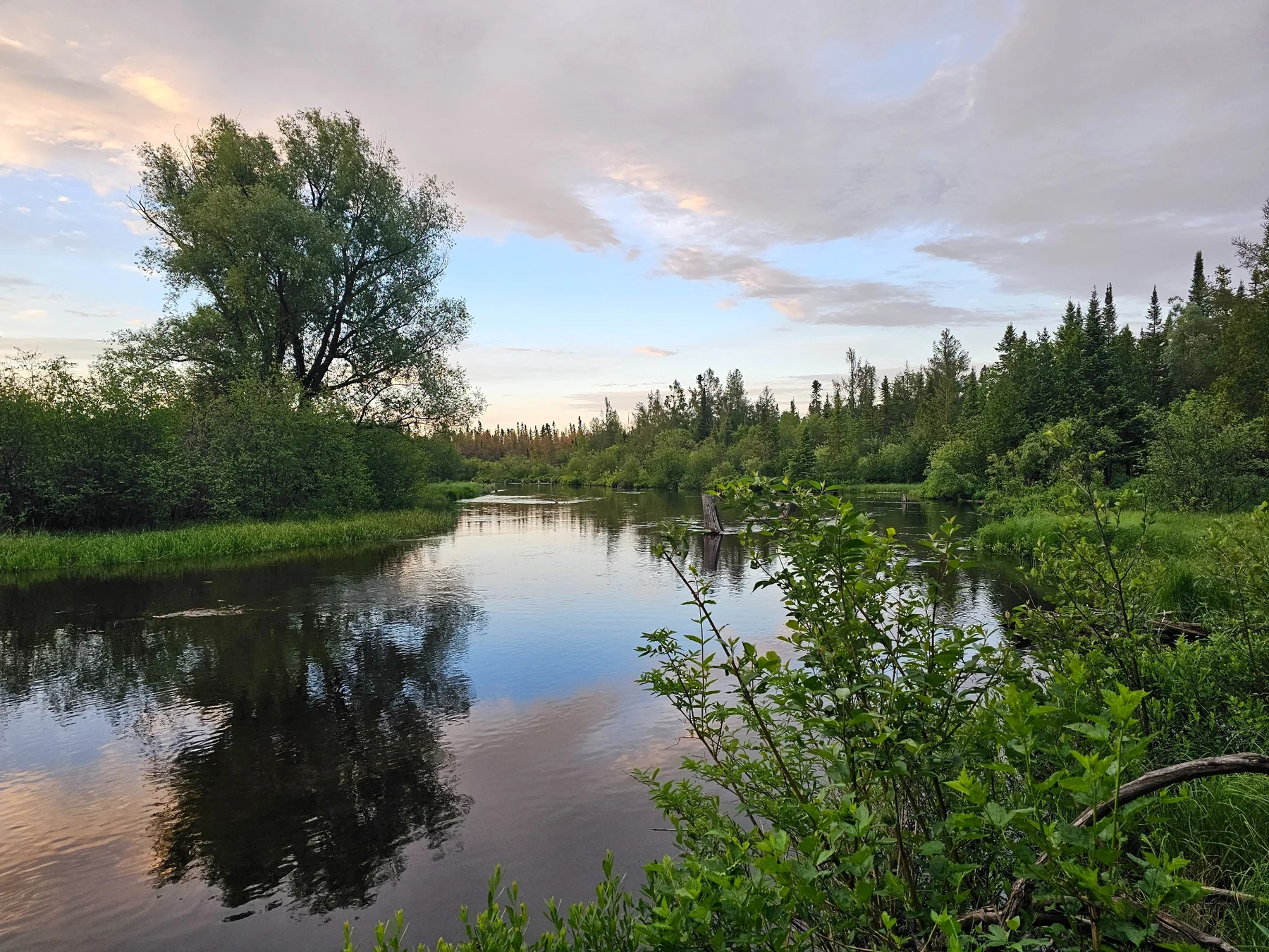
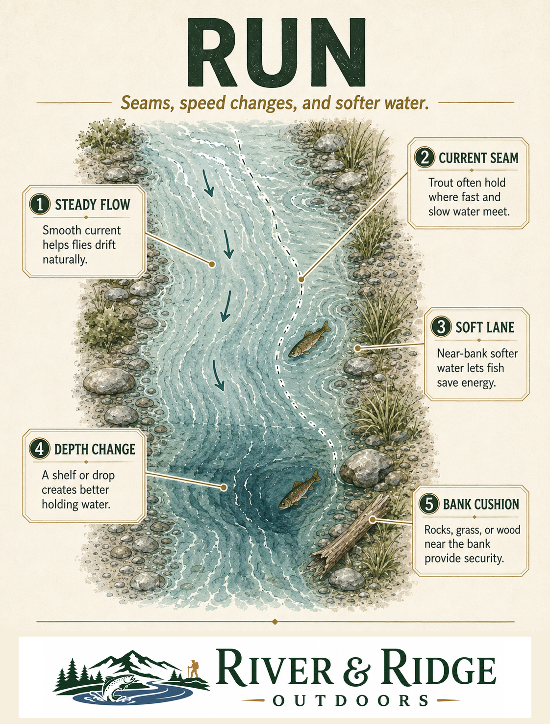
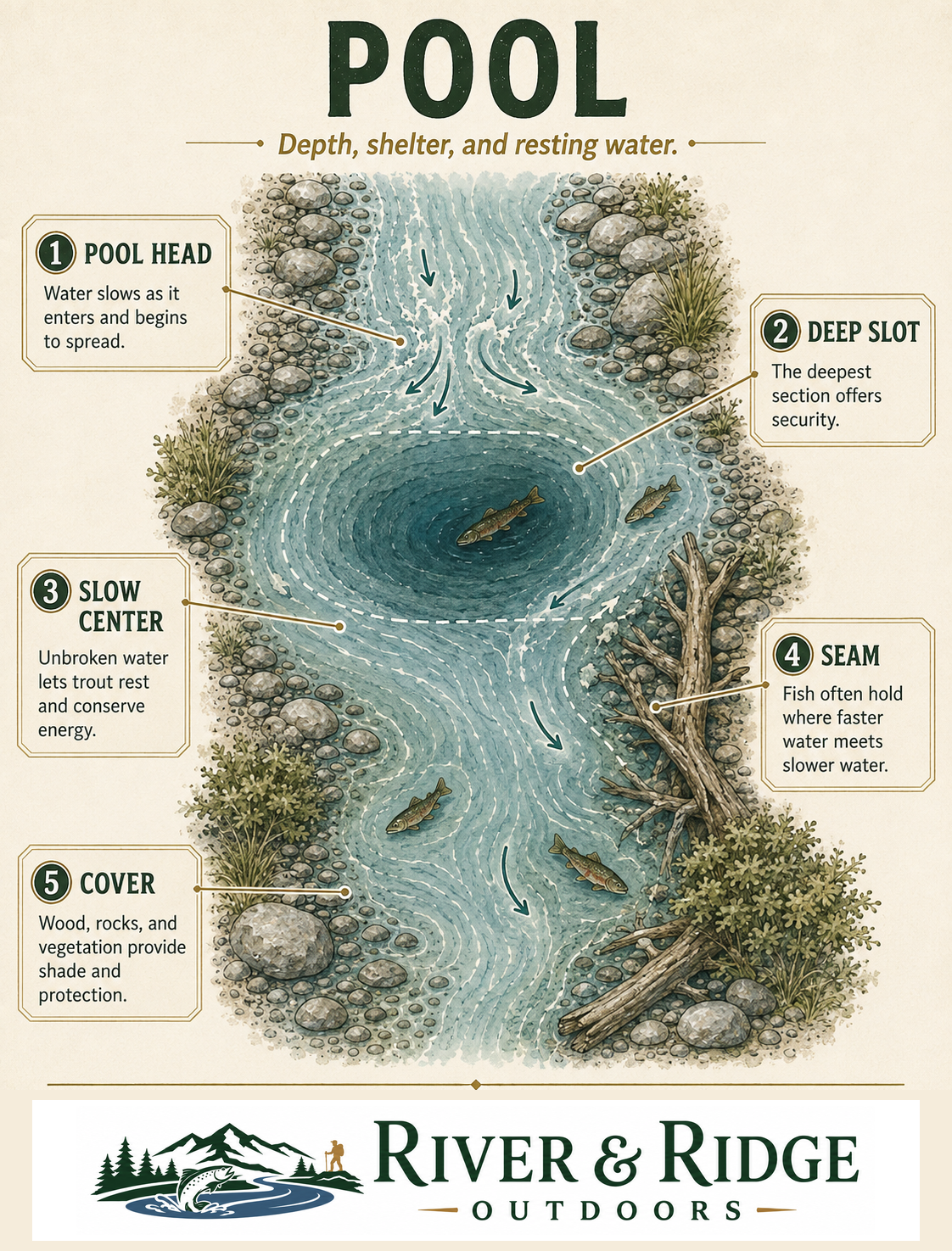
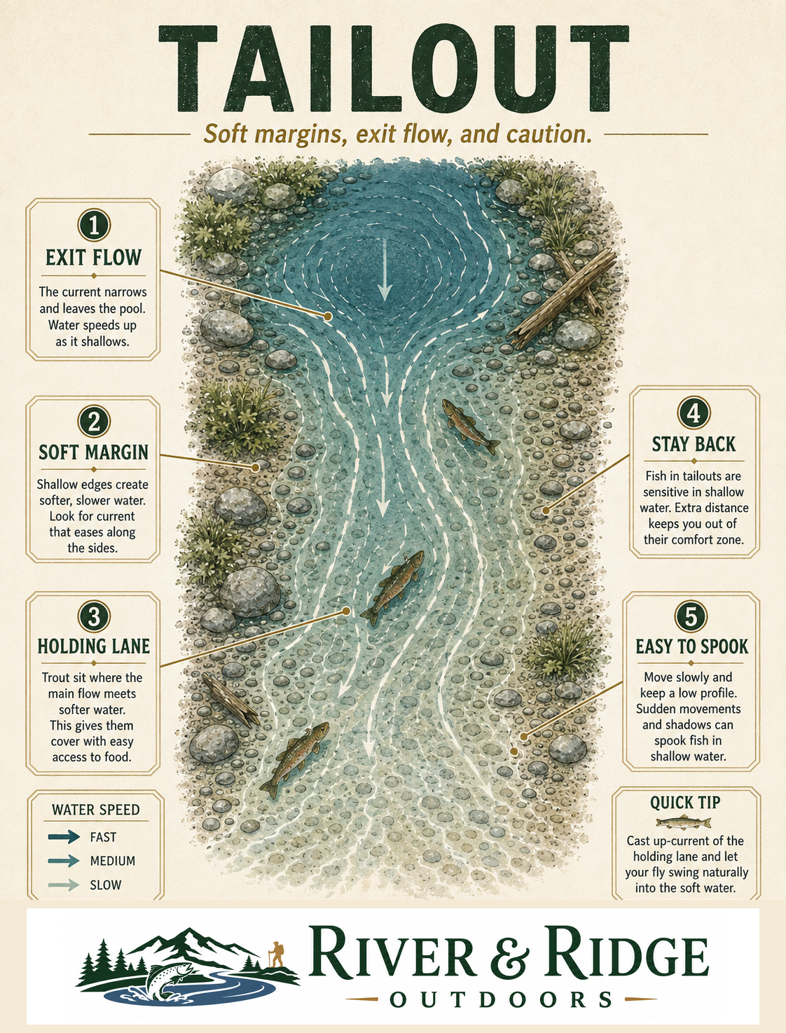
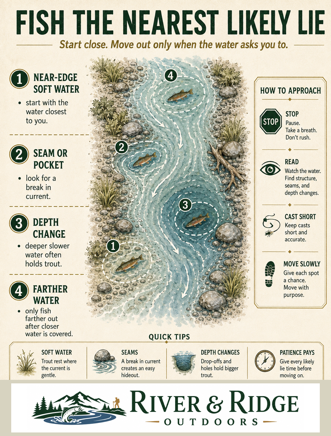
Real field photography shows the water as it actually appears. The illustrated guides make speed, depth, seams, cover, and approach easier to name.
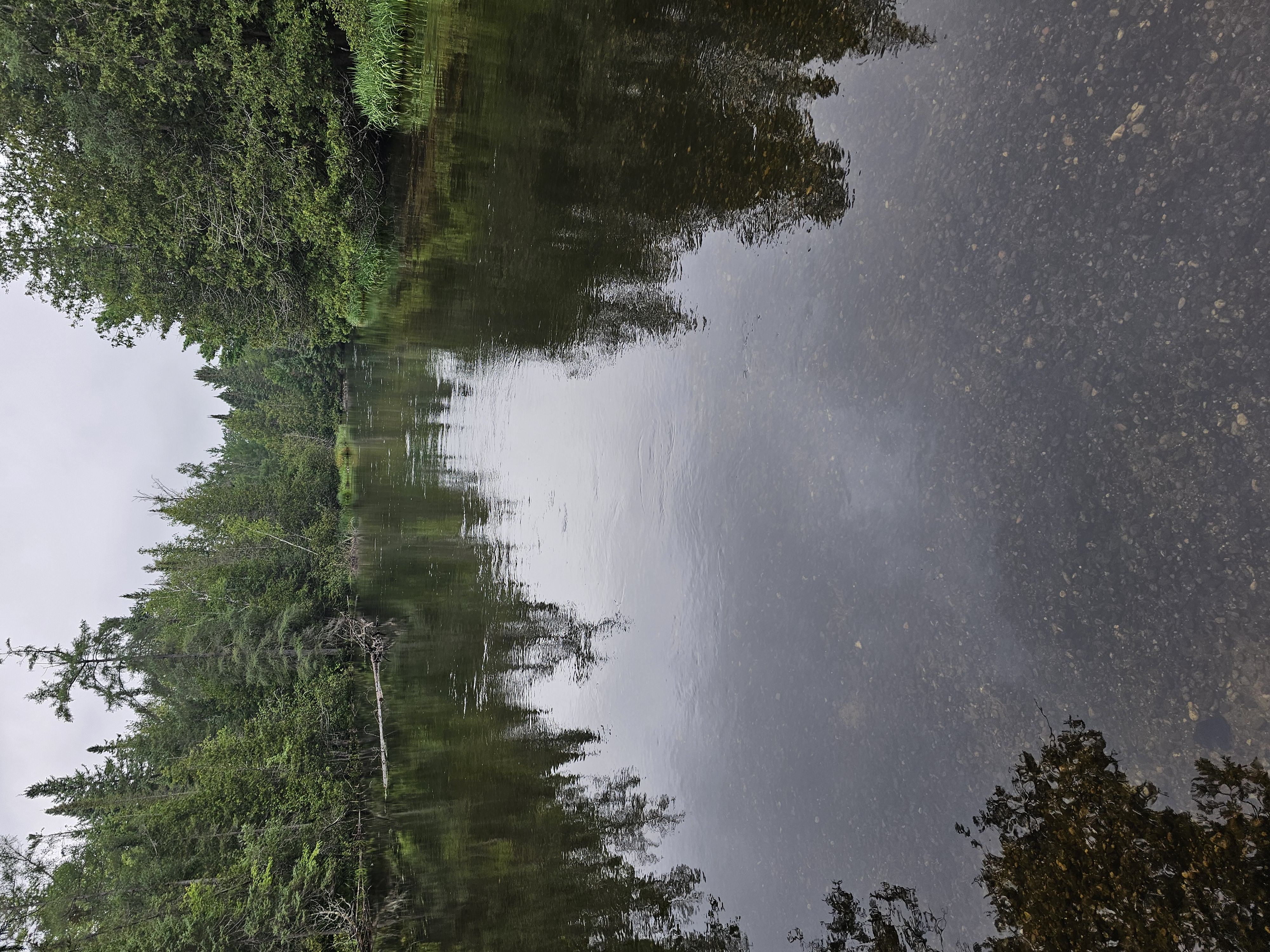
Watch texture, color, bubbles, and the way the current carries debris.
Look for seams, pockets, shade, wood, drop-offs, and softer water beside faster flow.
Begin with the nearest soft margin, trace the speed change toward the darker center, and use the illustrated Run guide to decide where a controlled drift belongs.
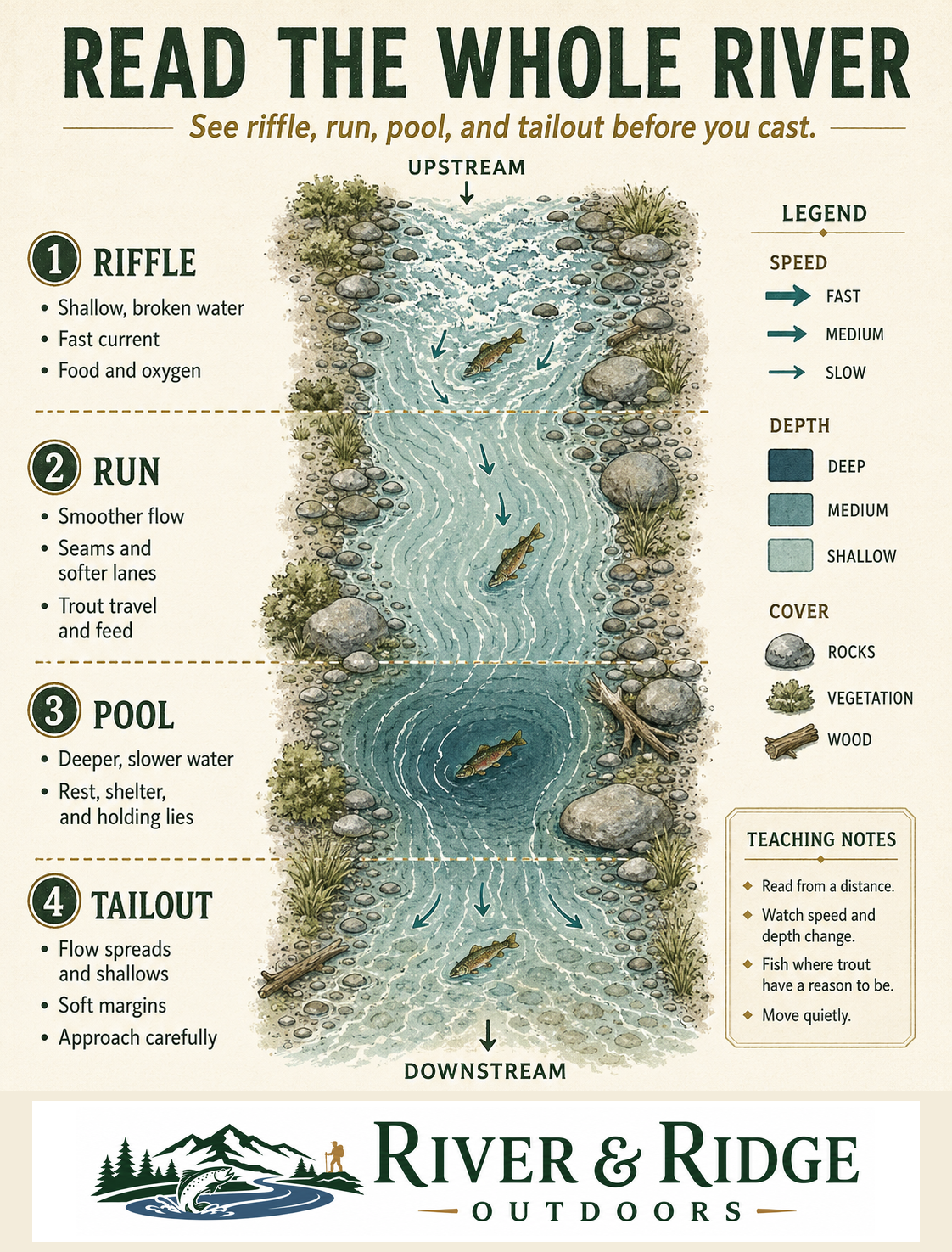
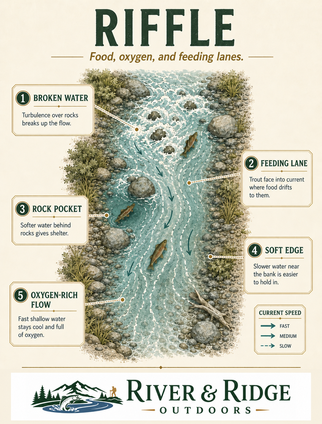
Field photos: River & Ridge Outdoors · Illustrated guides: RRO Training Illustration Library
Regional coverage
Use these descriptions to picture the river, its current, casting room, and common holding water. Open the regional map for individual rivers.
| Water family | Box fit | What the fishing is like |
|---|---|---|
| Pigeon River | Core water | A small-to-medium cold river with riffles, pockets, woody cover, and mixed brook- and brown-trout water. Short accurate casts and controlled drifts fit its quicker reaches. |
| Black River | Core water | Cold headwaters begin small and wooded, then gradually widen. Expect close casting, shaded pools, woody cover, and a mix of brook- and brown-trout water. |
| Sturgeon River | Core water | A fast, lively river with pocket water, broken current, deeper slots, and limited standing room in places. It favors quick line control, weighted subsurface work, and well-placed dries. |
| Rifle, Thunder Bay coldwater reaches & Hunt Creek | Strong fit | A useful range from tiny research-stream water to medium coldwater reaches. Fishing shifts from close, precise casts under cover to longer drifts through riffles and runs. |
Regional fit: These rivers share a northern coldwater box while keeping distinct current speed, structure, and hatch timing. Upper Au Sable uses its separate river-specific system.
Regional river map
Choose your river from the selection box or tap a numbered marker. You will see how the water fishes, how the box fits, typical wading, current temperature and weather, and where to begin.
Choose your river above to open its planning intelligence.
Map markers provide river-system orientation. Measured water leads the decision. The highlighted seasonal window provides historical context, and the local 24-hour forecast shows the likely warming or cooling direction. Active readings show their station and observation time. Current DNR regulations, verified public access, measured conditions, and posted information guide the trip.
Regional map ready.
Seasonal weighting
The season points toward the most likely insects and presentations. Current water temperature, weather, and what you see on the river choose the starting point.
| Window | What to watch and where the box has support |
|---|---|
| Early season | Hendrickson/dark mayfly, black caddis, general nymph, and stonefly/search roles; expect later timing toward the Tip. |
| Late spring–summer | Sulphurs, caddis, Cahills, film activity, faster-water attractor and nymph roles. Use large drake/Hex coverage where the local water confirms it. |
| Summer | Terrestrials, pocket-water dries, caddis, crayfish, and streamers where water temperature and rules support them. |
| Fall & cold water | Small mayfly/film roles, Isonychia where present, nymphs, and streamers; confirm seasonal rules and safe access. |
Current-condition and legal checks
Start with the current regulation for your reach. Then use water temperature, flow, weather, and local observations to choose access, care for trout, and adjust your presentation.
Matched physical system
The physical box gives you the flies and the field order. This page shows how to apply that system to this region, season, and river.
Improve this region
Tell us the river, reach, or question that would make your next trip easier to plan.
Give Feedback